By Eugene Buchanan –
Ever look at a trail map to see where you are on the slopes of Colorado’s myriad ski resorts? Should you take that black diamond shortcut to meet your friends at the lodge, schuss that blue square to save your knees or send your spouse or kids down one run while you rip another, with the promise to meet at the lift at the bottom?
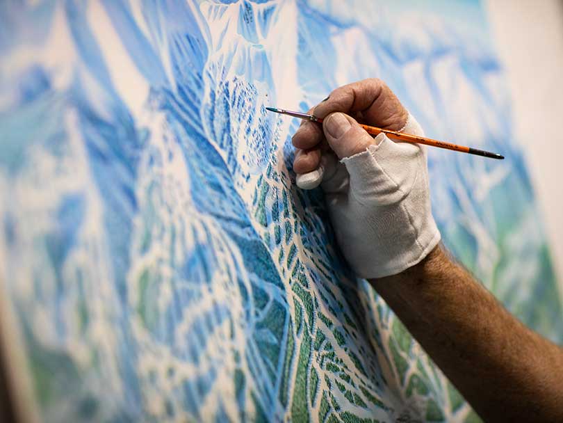
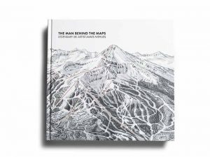
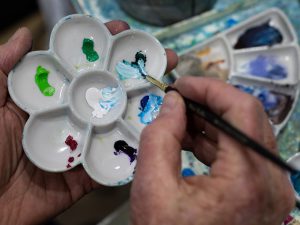
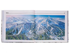
The man to thank is Colorado’s own James Niehues, a Parker artist who’s one of cartography’s last great analog mapmakers. Niehues built his career around hand-painting trail maps for ski resorts, down to the last tree. Last year he collated his collection into the coffee table book The Man Behind the Maps, which belongs in the fireplaced living room of every Centennial State skier. In all, he’s created maps of more than 200 ski resorts around the world, with another couple hundred of national parks, wilderness areas, visitor bureaus, golf courses and more.
“I always believed that someday I’d compile enough ski map paintings to make an interesting coffee-table book,” he says from his home in Parker. “I envisioned it more of an art book than a book of maps naming all the runs — a book to dream by. By the time I was 70 I realized it had better happen soon.”
Raised on a farm in western Colorado, Niehues always had a passion for landscapes and “loved a good puzzle,” a combination that lent itself to eventually portraying the serpentine slopes of ski resorts. But he didn’t start dabbling with a brush until he was a freshman in high school, immobilized for three months while recovering from the kidney disease nephritis. Hoping to relieve his bedridden boredom, his mother bought him an oil painting set and Niehues began tinkering.
Later, while serving in the U.S. Army in Berlin, Niehues convinced his sergeant to convert the basement of their old, World War II barracks into a studio. He eventually went on to major in art at Grand Junction’s Mesa State College (now Colorado Mesa University) but admits he’s still mostly self-taught. He later earned more stripes working at a print shop and as an artist for an aftermarket automotive manufacturer.
“I drew products like timing lights, gauges, tachometers and things, and designed packaging, brochures and instructions,” he says.
But tachometers weren’t quite what he wanted to do, and after seven years he turned freelance, working for such clients as Jim Cowden Advertising. When the trail map bug bit, he sought out the only people making them at the time: Bill Brown, who had been illustrating ski maps for a few years, and Brown’s mentor Hal Shelton. Niehues’ first project was helping Brown map the backside of Mary Jane at Winter Park.
“He liked my portfolio and gave me a small job,” Niehues says. “I tried to replicate his style and when he moved on into video production he helped me initiate my career as a trail map illustrator.”
Niehues’ first solo contracted ski project was for California’s Boreal Mountain and Soda Springs in 1987. Then executives at Vail saw it and hired him to do their mountain in 1988 — his first major resort. Interest in his work grew from there, and he soon realized he better learn how to ski if he was going to continue painting trails.
“I bought ski equipment and learned on the job, becoming an intermediate skier,” he says. “I am first an artist that loves landscapes, and second a skier.”
That doesn’t mean painting maps was much easier than making a parallel turn. Conveying a resort’s slopes onto a canvas, capturing its personality and turning it into a work of art can be as arduous as schussing a black diamond in a snowplow.
“The trail systems can be hard,” he says. “Some resorts are easy with a single face, but most have multiple faces that can span 360 degrees. I have a flat, blank piece of paper and have to manipulate, or artistically interpret, three dimensions into one — and make it understandable and accurate. It’s a romancing of the ski area.”
On satellite photos, he says, the trails are uninviting and narrow. “My job is to show them as they appear when you’re on the mountain,” he says. “First I lay out all the lifts and make sure they’re relative and that their base is down-page and vertical. Then I’ll review the aerials and fill in with slope shading, trees with shadows, rocks and other features.”
The result is nothing short of remarkable, from the shape and tones of puffy cumulus clouds floating over his map of Steamboat Ski Resort to the northern lights wisping over Alaska’s Alyeska Resort. He also somehow captured the adrenaline in paintings for Snow Country magazine of the 1992 Olympic downhill course in Albertville, France, and the Salt Lake City course for the 2002 Olympics.
“He has become the shepherd of skiers, guiding us through snowy landscapes that he creates with an authenticity that still defies computerized capabilities,” writes Jason Blevins in his book’s introduction. “No artist has had a more lasting impact on skiing. His maps are as much a part of the ski experience as chairlifts, groomed trails and hot cocoa … they urge skiers to visit, linger, return and explore.”
He’s created trail maps for 16 resorts in Colorado, as small as Monarch and Powderhorn and as big as Aspen Highlands and Snowmass. “It’s fascinating to see the outpouring of people who are into his work,” says Jeff Hanle Aspen Skiing Company vice president of communications. “He’s created this amazing little niche that people connect to.”
As for his ability to portray the Elk Mountains of Aspen’s resorts authentically, Hanle adds that, somehow, he nails it. “If you didn’t know better, they could be photographs,” Hanle says, noting they’ve also fastened the maps to the front of their chairlifts. “He’s great at using shading to give an accurate picture of what the terrain looks like. People can look at it and say, ‘Wow, that’s steep.’”
Like skiers negotiating the twists and turns of the slopes he paints, Niehues, too, has had to adapt to changes in technique from when he was tutored under Brown and Shelton.
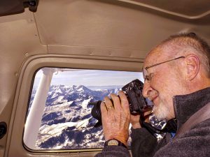
James Niehues on one of his many mountain flyovers. In 1988, Niehues would fly over the area shooting 36-exposure film. Today he uses a digital camera.
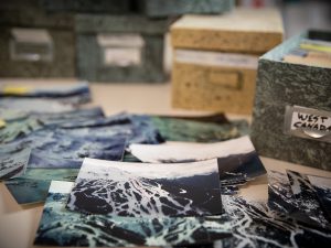
“A lot has changed in the 35 years I’ve been making them,” he says. “In 1988 I’d fly the area, shooting 36-exposure film, review the photos with the client, draw the sketch and then mail it off. It’d take weeks before I’d proceed to the painting, which I’d then convert to an 8-by-10 transparency with four-color separation, hand-drawing type and symbols onto layout boards.”
Today’s digital world has made things a lot easier, he says, but it’s still a puzzle to piece together and he still paints every one by hand. “But now I can just attach a photo of the sketch and email it out, and then upload the final,” he says. “Today’s process also allows much more control of color and easier updating.”
Like any artist, he’s had his favorites over the years — and also those problem children.
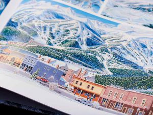
Appearing in his new book The Man Behind the Maps is “Breckenridge Mountain and Street Scene,” which was painted in 1989 for Snow Country Magazine.
“I’m a landscape painter, which means my favorite ones have a visual dynamic,” he says. “A trail map is the resort’s tool to get you around but also their visual fingerprint; it portrays the mountain’s potential to invite further exploration.” Some of his favorites include Alta, Big Sky, Blackcomb, Crystal Mountain, Jackson, Killington, Mammoth and Lake Louise outside the state; and in Colorado such resorts as Telluride, Breckenridge and Crested Butte. “If these were all framed up on a wall I’d pick out different effects, colors or compositions that I like in each,” he says.
And some are harder than others — like the ones with multiple valleys and aspect orientations to interpret and portray in a two-dimensional painting. Oregon’s Mount Bachelor comes to mind, he says, for its 360 degrees of skiing off the summit; and British Columbia’s Sun Peaks for the exact opposite: 360 degrees of skiing out of a tight valley.
“For Mount Bachelor I took what I call a ‘satellite perspective,’” he says, “because its south slopes have no distinct cuts — they’re running up-page but appear to be running downhill from color shading. For Sun Peaks I had to stretch the lifts to get proper distances between the bases and keep it all relative and credible.”
And as resorts grow and add more infrastructure —Vail’s Blue Sky Basin comes to mind — the problems with painting them also grow. “I’m more concerned with the slopes themselves, so it isn’t a matter of how modern the resorts are but how big they are,” he says. “Heavenly Valley’s slopes are the same today as in earlier days, but there are more base facilities and buildings to paint. While I don’t have to change perspectives to get them in, some of today’s terrain expansions make them harder.”
If fitting all of a resort’s trails onto a map is difficult, so was the task of compiling his work into a coffee-table book, which was released in 2019 to rave reviews and robust sales.
While it’s not in the book, his most recent map, finished just this year, is of Vermont’s Mad River Glen — another one of his favorites. “I flew over it early in my career while gathering aerials for Sugarbush,” he says. “I took only one photo and filed it away. It’d be fitting if this were my last one. Mad River has such a great history and tradition and it was a fascinating project. It’s a true skier’s mountain, complete with a one-person chair to the summit — it’s dotted with features that make it unique.”
Admitting he’s now “semiretired” and taking on only a few projects a year, he’s not sure if Mad River will be his last resort. He’s returned to his original passion of landscapes, starting a series of sketches of the country’s national parks. “I’ve directed many projects on to [map illustrator] Rad Smith but am always keeping an eye out for that special resort I’ve always wanted to do,” he says.
And this, of course, also gives him more time to practice what he paints and preaches: skiing. While he admits one of his favorite resorts to ski is way down south in Perisher, Australia, for its train-tunnel transition from lush, green valley to white ski slopes, he loves getting out and skiing the sites of his creations. “When I get out on the mountain, I love the exhilaration of experiencing the great outdoors and taking in the scenery,” he says.
And with the restrictions of COVID-19 this past year, he feels that’s more important now than ever.
“I think the book has remained strong through these last months because it offers possibilities,” he says. “I try to paint every feature clearly so people can explore and dream about how they would ski. The season was cut short last year and skiers want to make the best out of this season — hopefully the book will help.”
After all, his maps have certainly helped him as they have others. “Although it’s been nothing too serious, I’ve gotten lost at resorts also,” he says, “and have used maps to know what run or area I want to go to. But for the most part, I just point it downhill and know I’ll get to the base eventually.”
Eugene Buchanan, a freelance writer who makes his home in Yampa Valley Electric’s territory, has written about the outdoors for more than 25 years. As a former ski patrol member, he has skied some of these trails illustrated so well by James Niehues.

